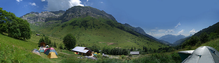
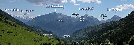
Near
Lake Annecy, the Montmin valley runs north and south at the foot of
Mt Tournette. The refuge is located near the northern end of the valley,
at 1200m altitude, just beneath the Aulp mountain pass.
Mt
Tournette (2357m) fills the view to the east. The valley opens to
the south and faces the Bauges mountain chain and the highest peaks
of Savoie.
The
name "Pré Vérel" likely is derived from the
franco-povençal term for the mountain alder.
It is thus the meadow of alders.
Click
HERE to view
a QuickTime panorama of Montmin valley